BIM (Building Information Management)
BIM consists of many components, which will become an essential part of today’s investments. It offers a traceable and transparent workflow based on close cooperation, continuous exchange of information, and procedures and solutions for their implementation. We are committed supporters of BIM-based planning, construction, and operation, because nowadays modern and efficient project management is only possible with an organized digital infrastructure. From September 2024, BIM will come under even greater scrutiny in Hungarian state investments, as the published “31/2024. (VIII. 22.) EKM Decree on the conditions for building information model (BIM)-based planning and technical implementation”. We have compiled a short extract of this decree, available here.
The workflow / process can be most effective if the BIM specialists are present from the very first moment of the project, and the basic pillars of the BIM approach and work organization are kept in mind even before the start of the project. BIM is not just a 3D model, but a sophisticated, detailed work organization and control tool. It is the investor’s / contractor’s interest to have a team of professionals working in close cooperation with the team managing the project, which has one main goal: that all work phases are carried out smoothly and with as little extra work as possible, so that the investment becomes comfortable and everyone participates in the project that satisfies all shareholder’s needs.
Of course, the entire BIM workflow can contain even more steps (scan to BIM / BIM audit / BIM design support / BIM construction management, technical implementation / BIM-based operation / Digital Twin).
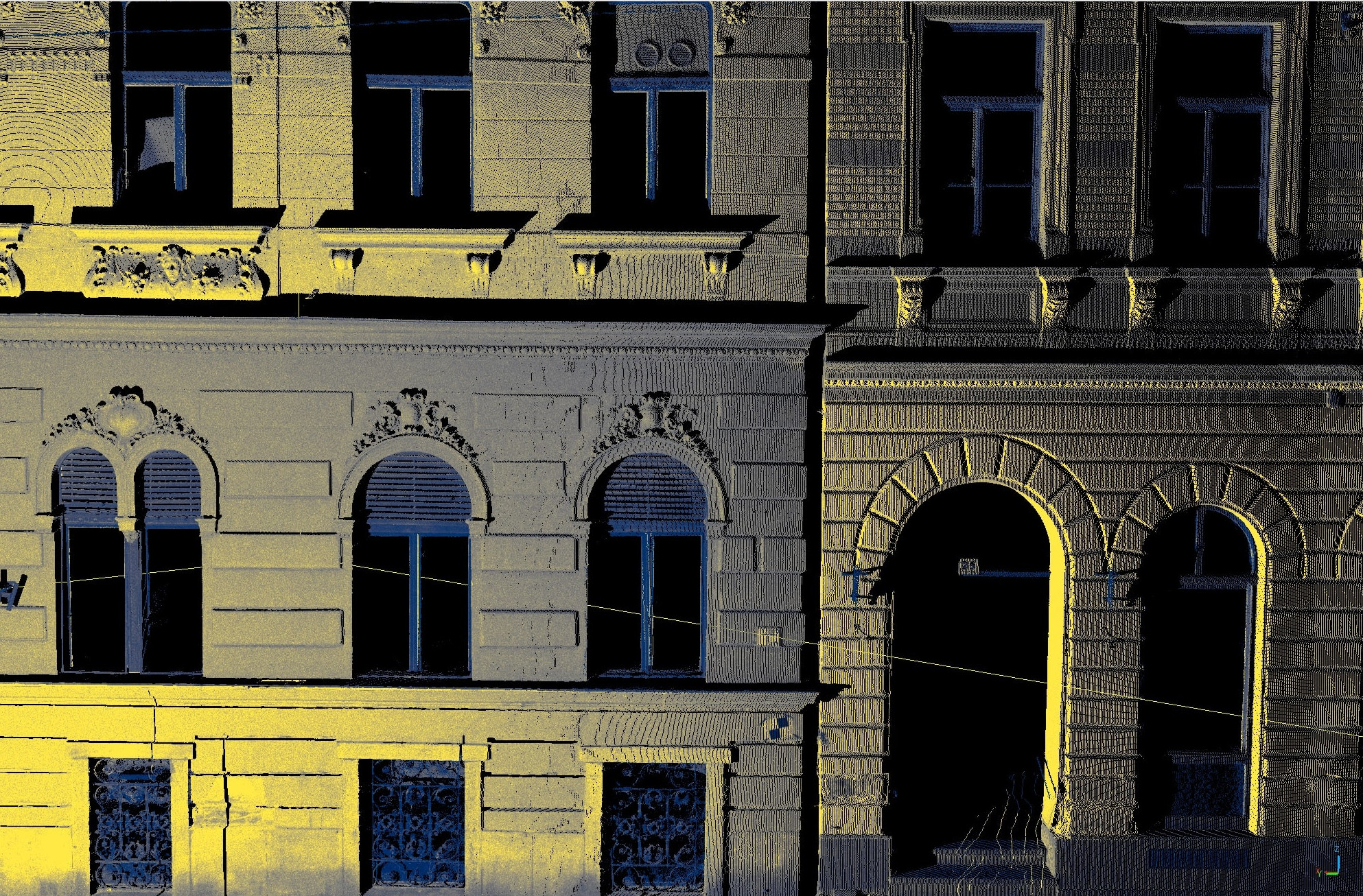
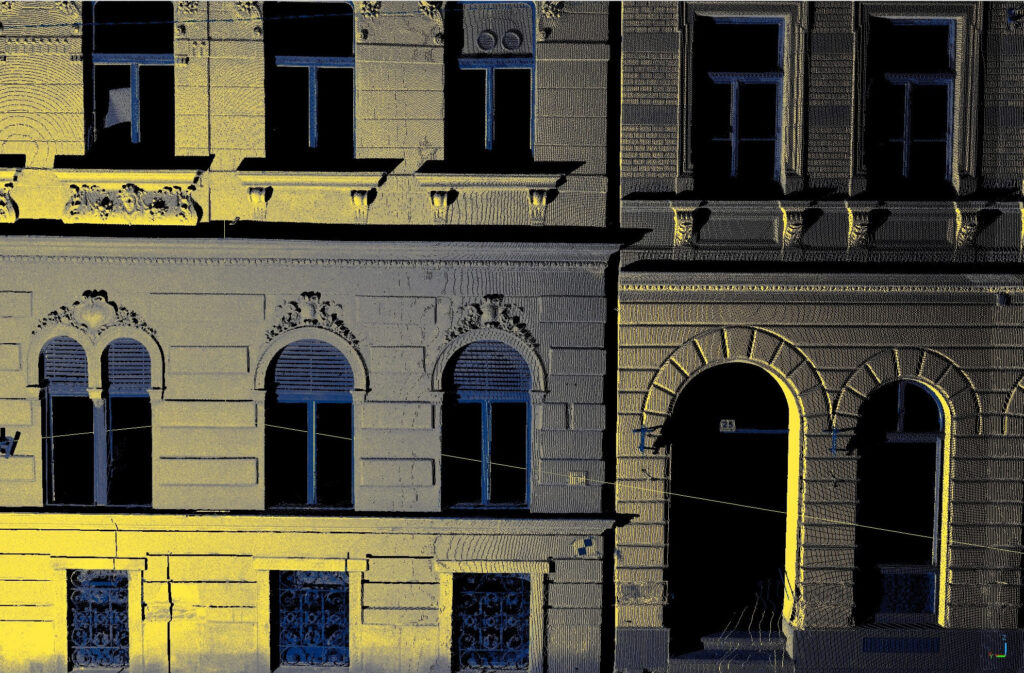
The 21st century, data is the “new oil”. Therefore, if you have data, you have value. In order to create data and value, these must be collected. If you want to digitize invisible objects (below ground or behind walls), you need special measuring equipment (e.g. georadar / soil radar / ground radar or wall radar). The job is slightly easier if you want to collect visible (above ground) objects. With the development of technology, the “collection” of visible points has improved significantly, today we can “collect” data not only with a total station or GPS – there are other instruments on the market. The laser scanner is one of the most effective professional data-collecting equipment for assessing surface terrain and above-ground objects such as buildings, utilities, roads etc. down to a millimeter accuracy.
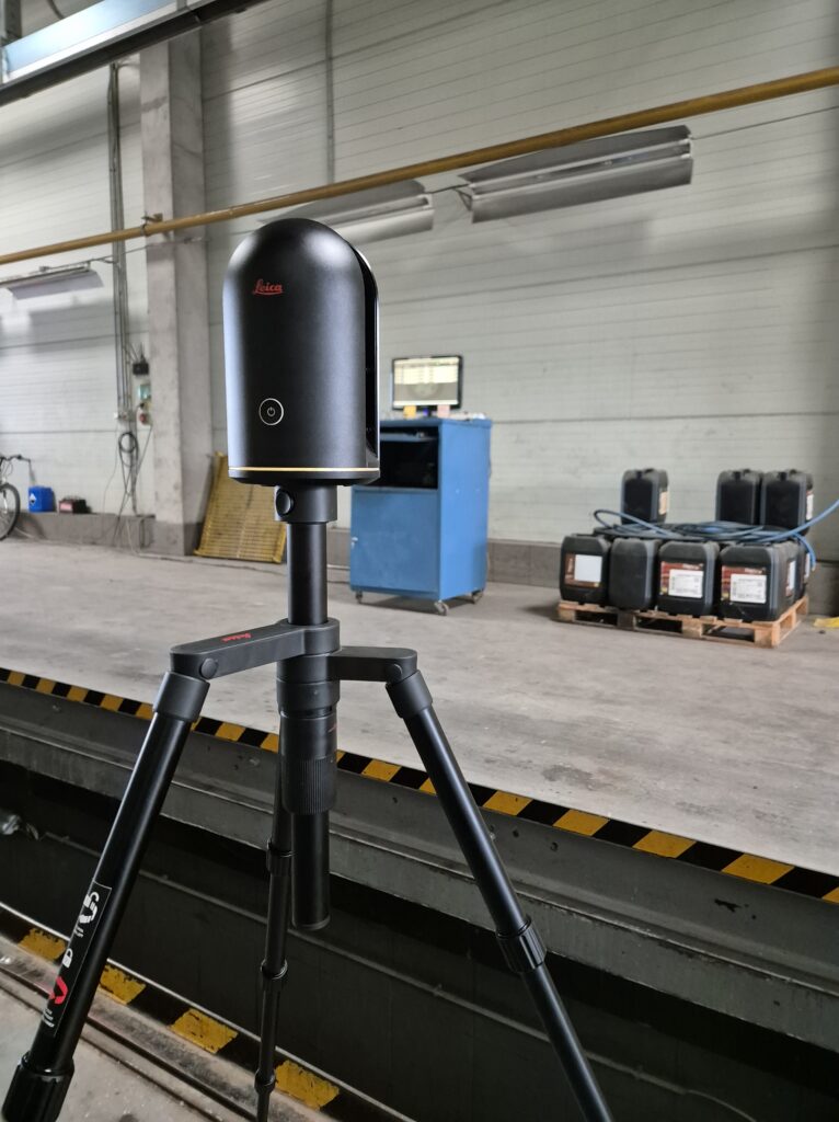
A laser scanner is an instrument that uses laser beams to measure and map the surroundings. It is primarily used to collect distance data and create three-dimensional (3D) models. Its operating principle is based on LiDAR (Light Detection and Ranging) technology, the basis of which is that the laser beam is directed at an object and then reflected from it. The device calculates the distance between the laser and the object based on the time of reflection of the laser. There are several types of laser scanners, we can distinguish between static (“stationary”) and mobile (“moving”) solutions. Depending on the amount and quality of data we want to collect, we need to choose the type of laser scanner.
Emitting a laser beam: A laser scanner emits a narrow laser beam that reaches the object or surface.
Reflection measurement: When the laser is reflected from an object in its “path”, the scanner detects this reflected signal.
Distance calculation: The laser scanner calculates the distance between the object and the measuring body by measuring how long it takes for the laser light to return from the object.
Data processing: The scanner collects millions of points, based on which a 3D model or “point cloud” of the scanned environment or object can be created. The point cloud is the real value, because digital models and drawings can be created from it.
There is no need to go out to the field multiple times. it is possible to extract the data in comfortable office conditions. We can use the laser scanner for construction monitoring also – it is a great equipment to use it for. After the data collection, we can compile the entire spatially located point cloud file (3D), which can be used immediately for visual inspection and control of the surveyed areas. A cost-effective and quick solution is to take panoramic photos at the individual measurement points and we can record the field conditions on the date of the survey.
The point cloud created by the data processing technician can be adjusted to a geodetic survey network, and this can also be used as a correct reference for the EOV (Uniform National Hungarian Projection System).
Architectural survey: Accurate 3D measurement of buildings, bridges, roads and other built structures
Survey of crane tracks: snaking test, span measurement, determination of height tolerance, measurement of dimensions / deviations
Monument protection: Documentation and reconstruction of historic / protected buildings and visible archaeological sites
Geodesy: For land surveying and topographic mapping
City mapping: quick and efficient recording of built and natural city elements
Industrial applications: For monitoring production lines and quality control
Autonomous vehicles: Self-driving cars are used to map their environment in real-time
Szolgáltatás
Szolgáltatás

Szolgáltatás
Szolgáltatás

Szolgáltatás

Szolgáltatás
Szolgáltatás

Szolgáltatás